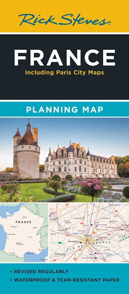
Rick Steves France Planning Map: Including Paris City Maps
Formats & Editions


Designed for Rick Steves fans, this map highlights France's best destinations in a colourful, easy-to-use format on high-quality paper:
- Cuts the Clutter: While big cities are included for navigational purposes, this map focuses on Rick's favourite spots for travellers
- Guidebook-Friendly: At a glance, all the places you read about in Rick Steves France stand out in a crisp, easy-to-read format
- Durable Construction: This map is printed on tearproof paper to last over many trips
- Road or Sea: Includes highways, ferry routes, bus stops, and train lines for easy route-planning
- The Back's Even Better: The reverse side includes a detailed city-centre map of Paris locating sights, hotels, and restaurants, plus a handy Paris Metro map


Find a book you'll love, get our newsletter
This site is protected by reCAPTCHA and the Google Privacy Policy and Terms of Service apply.
© Hachette Aotearoa | New Zealand, All Rights Reserved · Site by Chook